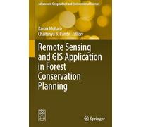
Remote Sensing and GIS Application in Forest Conservation Planning
Remote Sensing and GIS Application in Forest Conservation Planning

Prix le moins cher
Habituellement expédié sous 9 à 10 jours
Prélèvement bancaire
Prélèvement bancaire
Visa
Visa
Mastercard
Mastercard
223,79 €
Livraison à partir de 0,01 €
Remote Sensing and GIS Application in Forest Conservation Planning

Prix total le moins cher
3 à 5 jours ouvrés
Prélèvement bancaire
Prélèvement bancaire
Visa
Visa
Mastercard
Mastercard
223,80 €
Livraison gratuite
Remote Sensing and GIS Application in Forest Conservation Planning

Habituellement expédié sous 1 à 3 mois. Livraison Express possible avec Amazon Premium.
Prélèvement bancaire
Prélèvement bancaire
Visa
Visa
Mastercard
Mastercard
225,78 €
Livraison gratuite
Remote Sensing and GIS Application in Forest Conservation Planning - Détails
▶ Trouvez toujours le prix le plus bas !
Nous avons trouvé 3 prix pour Remote Sensing and GIS Application in Forest Conservation Planning. Notre liste de prix est toujours transparente et affichée par ordre de prix croissant. Des frais de livraison peuvent s'ajouter.
Remote Sensing and GIS Application in Forest Conservation Planning - Informations sur les prix
- Prix le plus bas: 223,79 €
- Le prix le plus bas est proposé par amazon-marketplace.fr . Vous pouvez commander le produit ici.
- Le prix pour le produit Remote Sensing and GIS Application in Forest Conservation Planning varie entre 223,79 €€ à 225,78 €€ avec un total de 3 offres.
- Méthodes de paiement: le marchand en ligne amazon-marketplace.fr accepte : Prélèvement bancaire, Visa, Mastercard.
- Livraison: le délai de livraison le plus court allant de Habituellement expédié sous 9 à 10 jours jours ouvrés est proposé par amazon-marketplace.fr
Produits similaires

103,60 €
amazon-marketplace.fr
Livraison à partir de 7,71 €

38,72 €
amazon-marketplace.fr
Livraison à partir de 10,00 €

63,92 €
amazon-marketplace.fr
Livraison à partir de 2,99 €

67,13 €
amazon-marketplace.fr
Livraison à partir de 3,00 €

36,92 €
Amazon.fr
Livraison gratuite
N'oubliez pas votre code promo :
Signaler une infraction
Vous êtes sur le point de signaler une infraction légale sur la base de la loi sur les services numériques de l'UE.